Time series analyses of high spatial resolution remote sensing data (Sentinel-2), climatology and auxiliary geoinformation datasets about the environment are used for habitat suitability index model. With this model we aim to map up-to-date areas where different locust species find favorable hatching conditions.
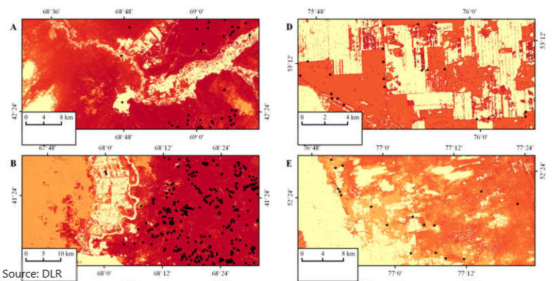
Figure: Habitat Suitability Index (HSI) for selected test regions in South Kazakhstan. Black dots indicate presence of Moroccan Locust (DMA) based on ground survey data. Dark red color indicates areas with very suitable and yellow pale color unsuitable conditions.